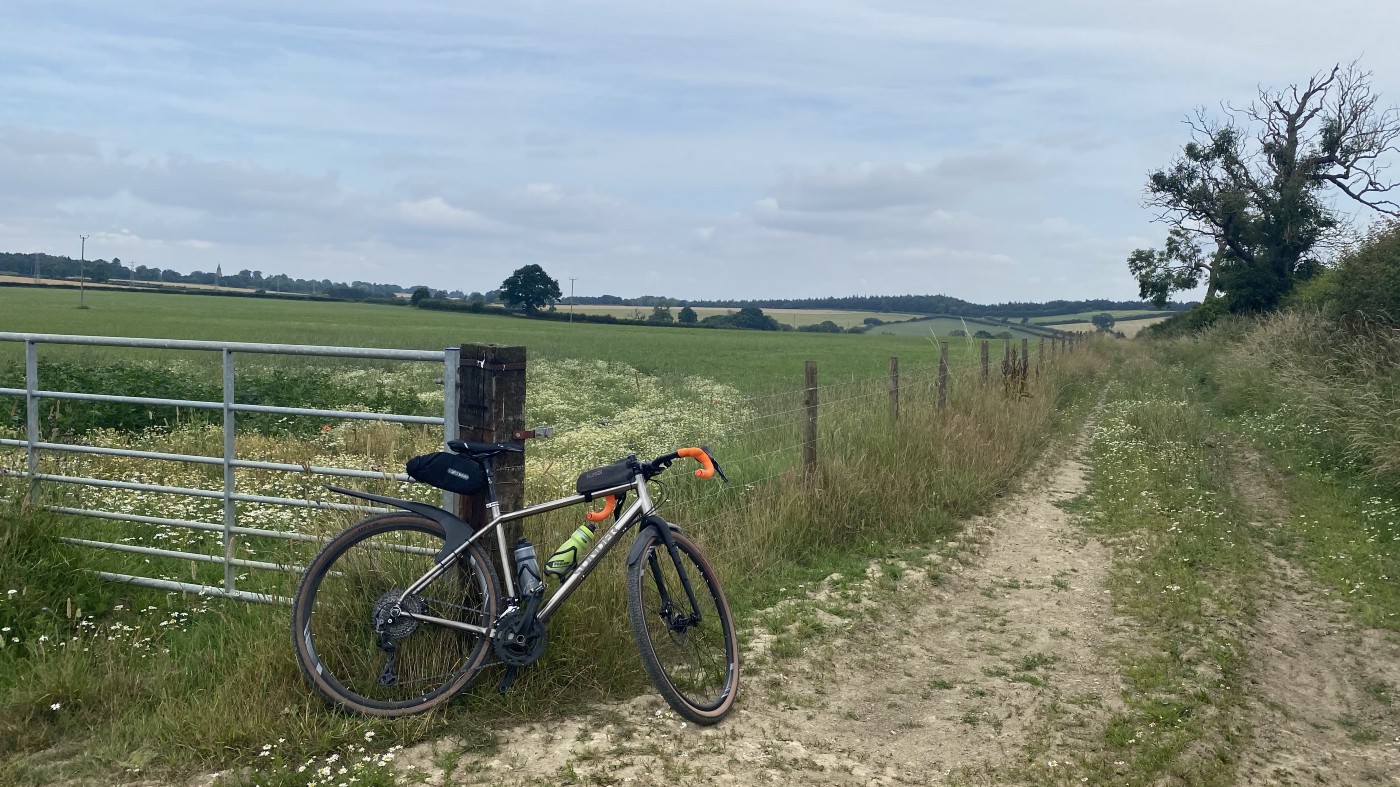
Riding the EnglanDURO route
A quiet, challenging, mostly off-road route from Liverpool to Scarborough
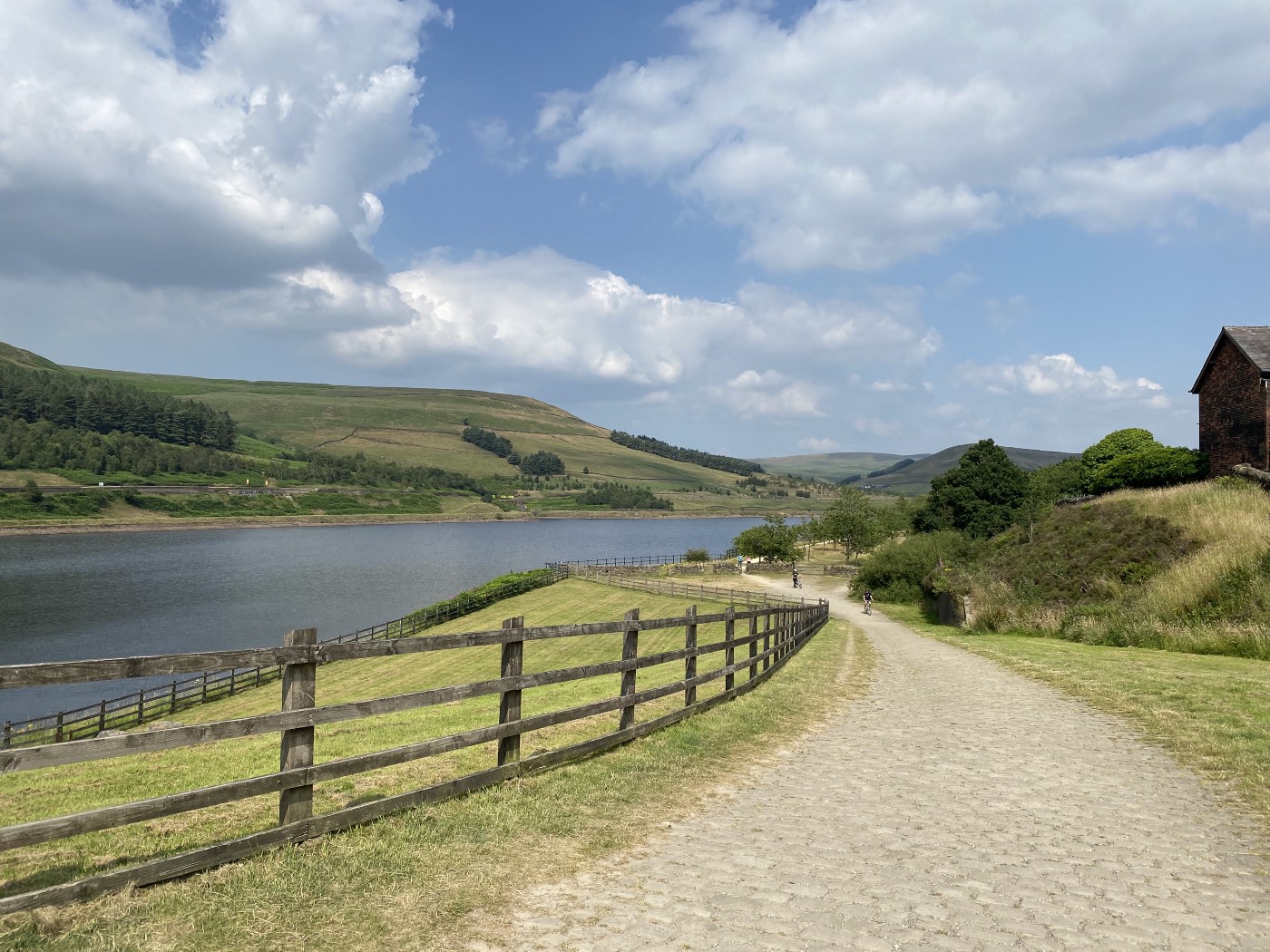 Woodhead Reservoir, three quarters of the way up the biggest climb of the trip
It’s been a long time since my last multi-day adventure ride back in 2013. I’d almost forgotten what it was like to get into the trance. Spinning the pedals, taking in the scenery, thinking about the next milestone, and yet still feeling a long way from the end. This time I was riding along with audiobooks and music instead of friends and family (thanks jobs and pandemic 🙄), but as soon as I set off I felt that calm focus of knowing there was only one thing to do today, and it would take all day.
I should mention that I didn’t bivy or ride self-supported, which is a bit against the spirit of the Racing Collective events. With my dad just round the corner and eager for a road trip, we had a great excuse for a family adventure even though he can’t cycle. I was quite grateful for this in the end — not just because I get on well with my parents, but also it was nice to have someone to chat to. Riding solo suits many people, but I found myself itching for someone to share my highs and lows with as the trip unfolded.
The route
The Racing Collective’s EnglanDURO event is the first weekend of August. I had other commitments, so rode it a week or so early. The route starts at the Liverpool seafront, and snakes its way northeast to the sandy beaches of Scarborough. Despite passing through Liverpool, Warrington, Stockport, Wakefield, Castleford and York, the towpaths, bridleways and cycle routes never felt too built-up or busy.
Before leaving I was a bit nervous about the trails being busy with walkers. There’s a lot of distance to cover, but it’s not cool to shoot past people at 25km/h just because you’ve got a goal. Thankfully this wasn’t a problem at all. Other than a slow canal-side section in York where many were enjoying the sun, paths were often wide enough to ride at a reasonable speed, and elsewhere it was pretty quiet.
My parents live in Castleford, so it made a perfect break in the trip, breaking it into a longer 170km first day with 1500m height gain. That left day two with 130km and 500m less height gain (in theory).
We set off early to drive to Liverpool, and I was cycling along the waterfront by 8am, passing a steady stream of commuters, runners and dog walkers. The cycleway is wide, flat, and has great views to shipyards and the wrecks of old piers across the water. It felt great to build up some momentum right at the start, even though there wasn’t time to stop and look at the myriad statues and memorials along the front. I soon joined the Trans-Pennine Trail around Hale, which I’d be following for most of the day, and the first hike-a-bike section, carrying the bike up a switchback of stairs by Ditton Marsh. After the fast, open start, the slow trudge up the steps felt like a bit of a setback, but don’t fear: there are only a handful of these on the entire route.
The first 80 kilometres wind peacefully along the Mersey with the terrain and views changing frequently. I’d been expecting more “industrial heartland”, but the cycle route manages to hide it away behind trees and inclines. Blips of business like John Lennon Airport were short-lived and soon forgotten. Despite the gentle gradients, I wasn’t fooled. The climb over Woodhead Pass loomed in the distance, waiting to see if I had enough energy left for the last big push. Thankfully that climb ramps up slowly, at least until you cross the A628 when you wonder when you’ll need to push. The reward is continuously amazing views (e.g. the photo at the top of this page), and friendly exchanges with other cyclists and walkers. No-one is finding that climb easy!
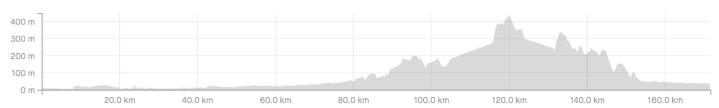 Elevation profile for Liverpool to Castleford
With the biggest climb behind me, I had a big grin on my face down to Penistone. The official route turns off Windle Edge to touch Winscar Reservoir before descending off-road to Townhead. This path is now private land with no access, so I retraced my steps back to the main road. From Townhead the route jumps back off-road to follow the River Don down into Penistone, where the last significant climb of the day awaited.
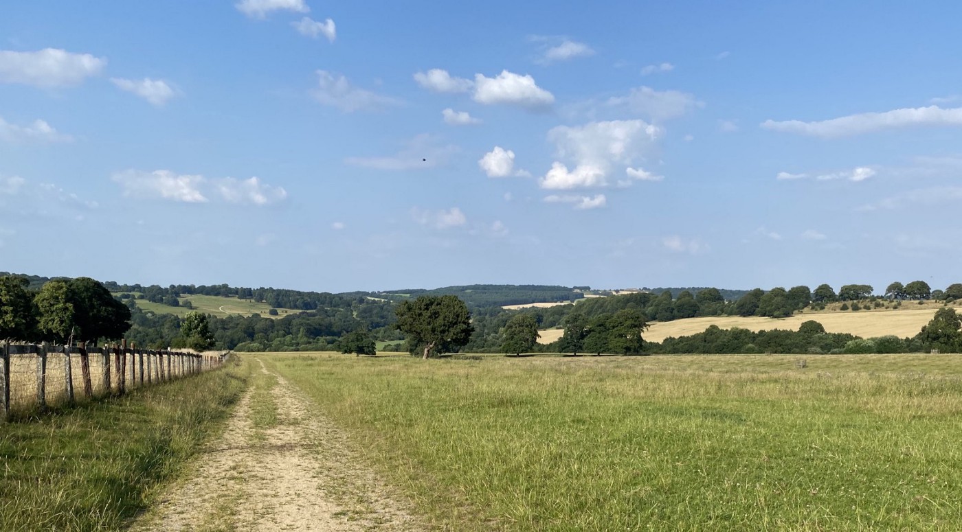 The descent into Bretton Country Park
After spending so long climbing, the long undulating descent was a playground for the energy I somehow managed to conjour in my legs. The area around Bretton Country Park and Yorkshire Sculpture Park was absolutely beautiful, with fast, flowy, open trails. A short glance at the lake at Pugneys Park was next, before joining the canal towpath that I knew would take me all the way into Castleford. There was a tiny hitch joining the canal — the last 100m of the path that joins Pugneys to the canal was closed. A bit of back-tracking (and some helpful people who’d just come the other way) led me out, and then it was just glorious, flat towpath that led to food, stretching and sleep after eleven and a half hours on the bike.
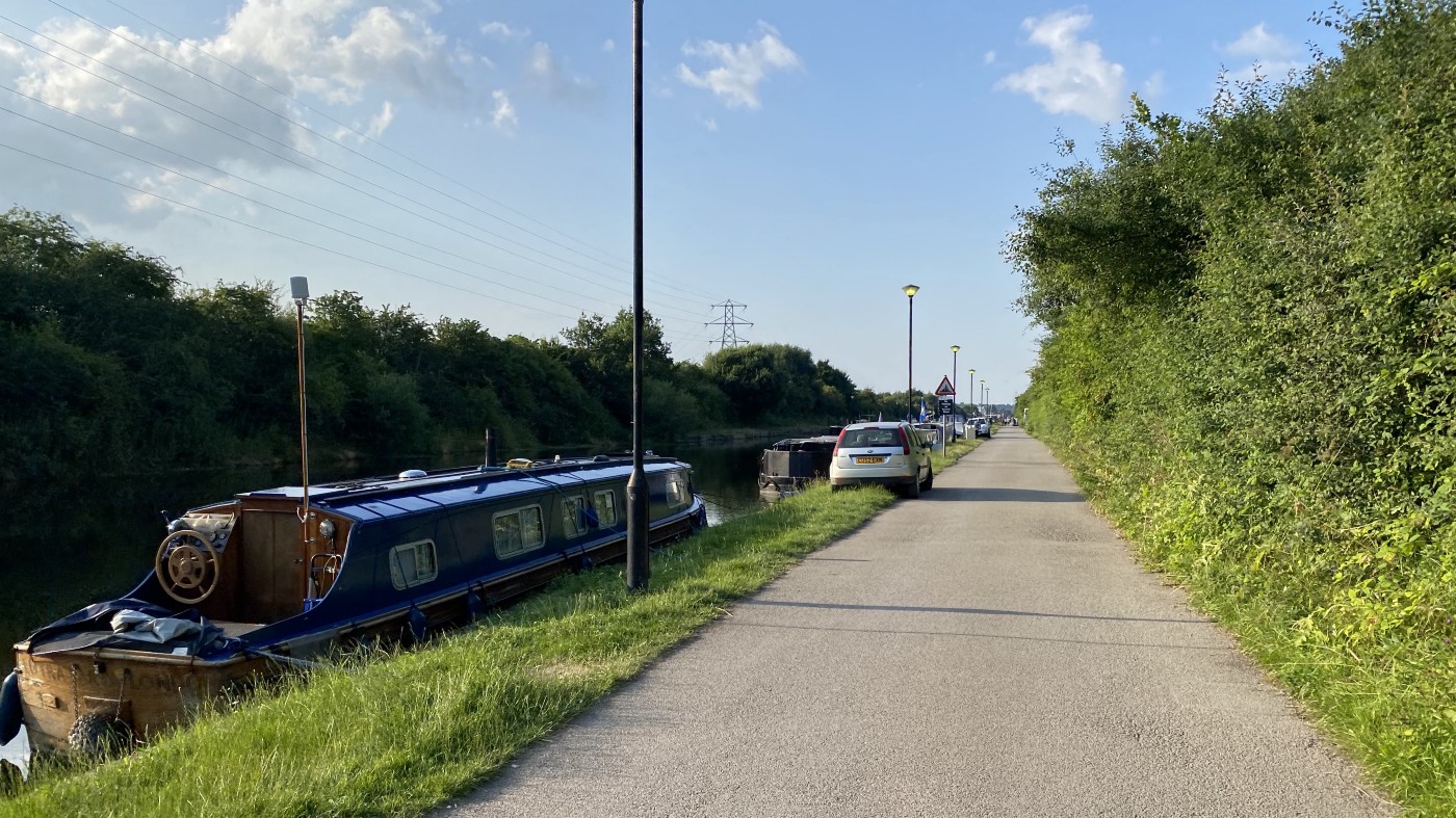 The stretch of canal before Methley
A route of two halves
I’d been quite nervous about the second day, and cautious about how much my pace would drop with tired legs, so I set off before 7:30am. I don’t know where this fear came from — we didn’t have a deadline to arrive in Scarborough other than “before the fish & chip shops close”, but when you’ve not done the distance in a while it’s easy to assume you’ll be crawling along at a snails pace.
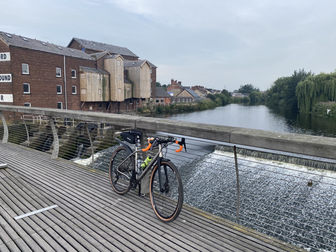 Castleford weir.
It was this photo on the Racing Collective site that made me realise the route passes so close to my parents’ house
Thankfully for said tired legs, I started with a gentle stretch along the towpath with cool, clear skies and a little dew on the ground. I had a crisis of confidence when the route turned off onto a walkers-only footpath through Fairburn Ings. Normally I’d figure out a cycle-friendly alternative, but being a bit tired and wanting to make progress, I decided there probably wouldn’t be anyone there so it’d be okay. My guess was correct, and I popped out the other side to start the first climb of the day over to Ledsham, which was a nice quiet path through the woods.
The following 30km on road and paved towpaths felt fast, and set the tone for the day. Where the first day had been 60% dirt, day two was 70% paved, which had the unexpected benefit of increasing my pace even though I was a bit more tired. Slowing down in York to carefully pass walkers and other cyclists enjoying the sun, I was reminded that today was supposed to be overcast with rain. Lucky!
 The hills before Kirkham Priory
After York things returned to what I’d expect from a ride in Yorkshire. Hills. Up and down. Short, sharp efforts. And great views. Passing Kirkham Priory brought back childhood memories, and I was more than happy to wait for the trains to pass in the valley before the crossing reopened. There’s a significant climb that reaches 17%, which was a really convenient point to lose signal and have my audiobook cut out. Again, it’s hard to complain because the road was quiet, and the surface pretty good.
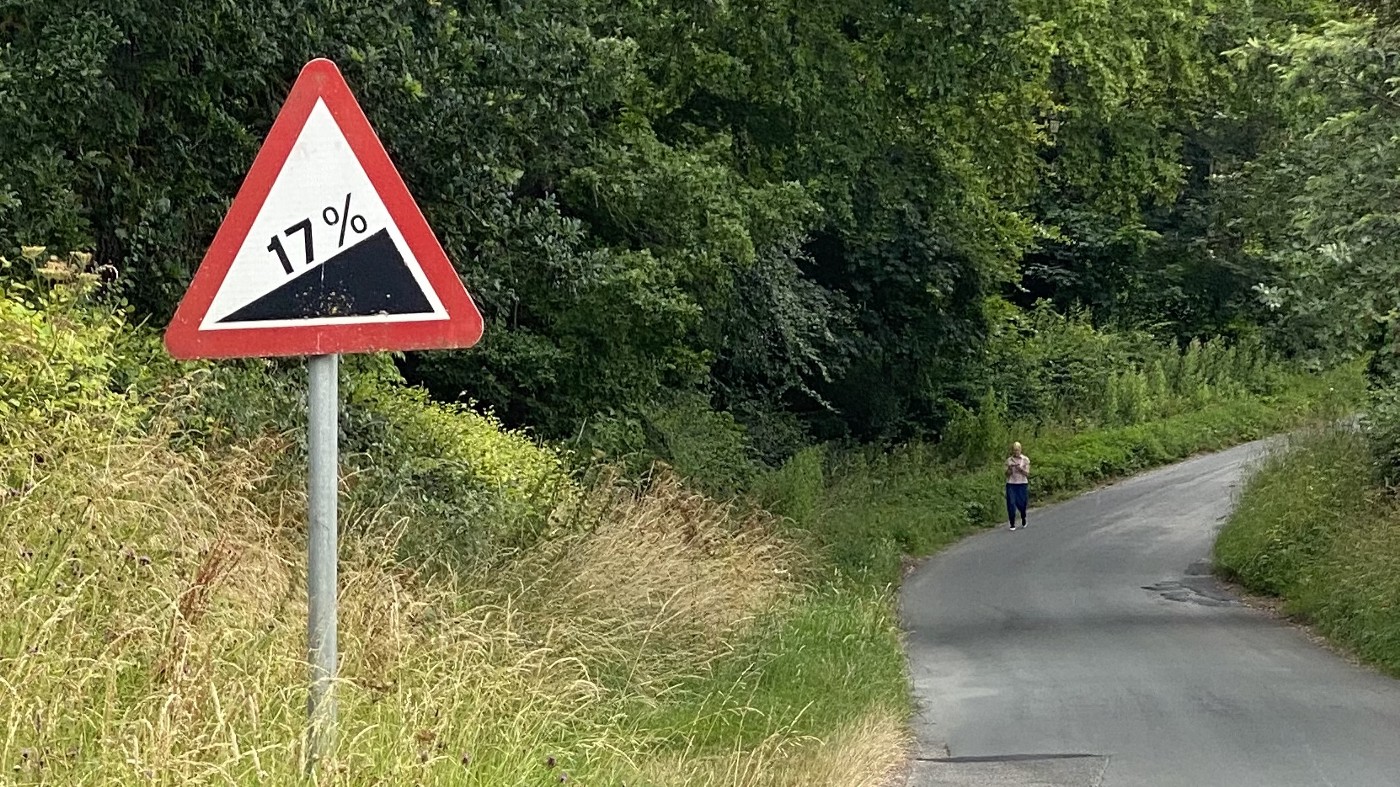 🥵 At least they let you know it’s coming
I’d studied the elevation profile for day two, so I knew that after this climb there was a good rest before the final significant hill of the day. The big one, albeit a lot smaller than Woodhead Pass of yesterday. I realised I could make it to Scarborough. One more big hill wouldn’t stop me, and my legs felt pretty good. I passed the Cayley Arms, crossing the main road to start the climb. Fortunately it’s closed on Tuesdays, otherwise I can’t say for sure that I wouldn’t have succumbed to the lure of a cold drink and a rest. At the base of a steep climb it would have been a bad call.
 Near the summit in North Riding Forest Park
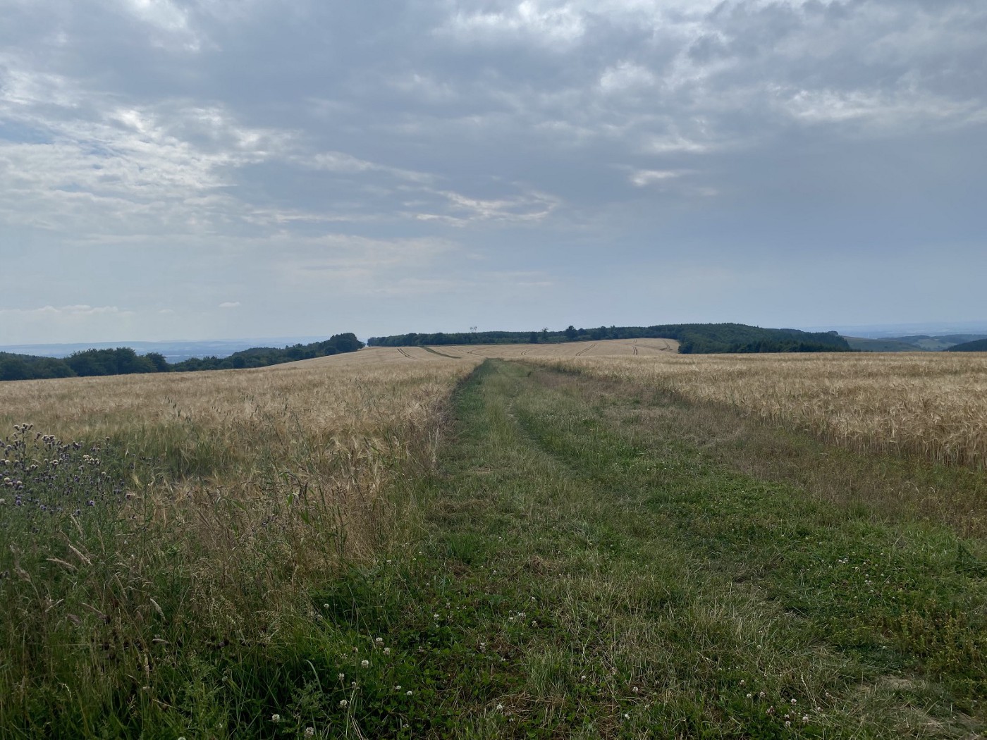
The climb up into North Riding Forest Park was actually pretty pleasant. The road had no traffic and only the occasional walker. It’s gruellingly steep in places, but gets its steepness out of the way in the first half before trading road for track and easing off the closer you get to the top. The last gentle climb followed tracks through fields. On any other day these would have been a joy to ride, but after several days of warm sun the track was rock hard and pitted with footsteps and hoofprints. This left a knobbly trail that juddered the gravel bike and shook me to my core as I tried to build up speed after the slow climb. Things just got better and better as field led to smooth, wide forest track, and I chased a motorbike as we both sprinted down the long straight trail with tall trees either side. What a feeling. This was the last big climb of the trip, and I knew Dad was parked up at the end of the trail with snacks and cool drinks. It was only when I met Dad that I heard the bad news…
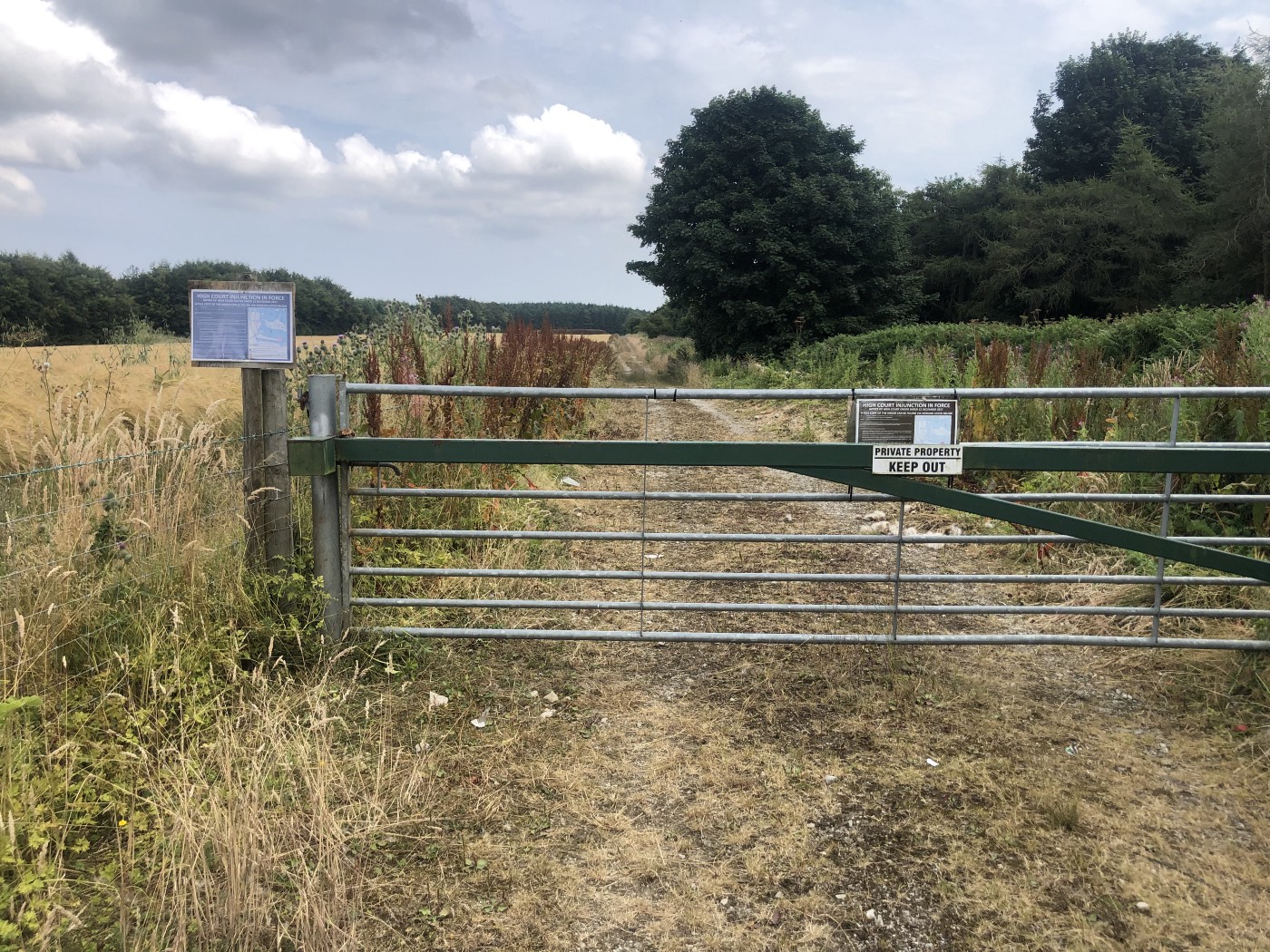 🤬 I thought this track was blocked
They really don’t want anyone in there. I’d already used my “I’m normally good so it’s okay if I break the rules” card back at Fairburn Ings this morning. Fair cop. A quick look at the map showed this is the only track north. My only option seemed to be to head south to Ebberston and suck up a stretch on the busy A170 before turning north again to get back to the route. I was a bit demoralised at the thought of going in precisely the wrong direction, and doing a 15km round-trip to bypass 1km of closed path, and my mood didn’t improve as I realised the descent to Ebberston wiped out all my height gain. In Snainton I turned and re-climbed the hill, grumpy until I remembered how fortunate I was to be out there in the first place. Sure it was an unexpected hill, but it just meant I got to spend more time on the bike. I was still well on track to arrive in Scarborough in time for dinner. It was worth climbing back up for the stretch across Wykeham Forest and a steep descent on road towards Hackness.
Update: Thanks to North York Moors NP, it looks like I just missed a bridleway to the right of this photo.
The route left the road for one last hurrah, climbing up gently in woodland on established trails. Eager to drop into Scarborough, of course it was here that I met a walker who just needed someone to talk to. What started as a request for directions took a surprising turn into a life story about divorce, moving to Birmingham, and disdain for their neighbours. I felt quite uncomfortable when he started sharing his views about people on benefits, but chose escaping over setting him straight. They were so reluctant to let me go, striking up new lines of conversation. I hope they find someone to talk to.
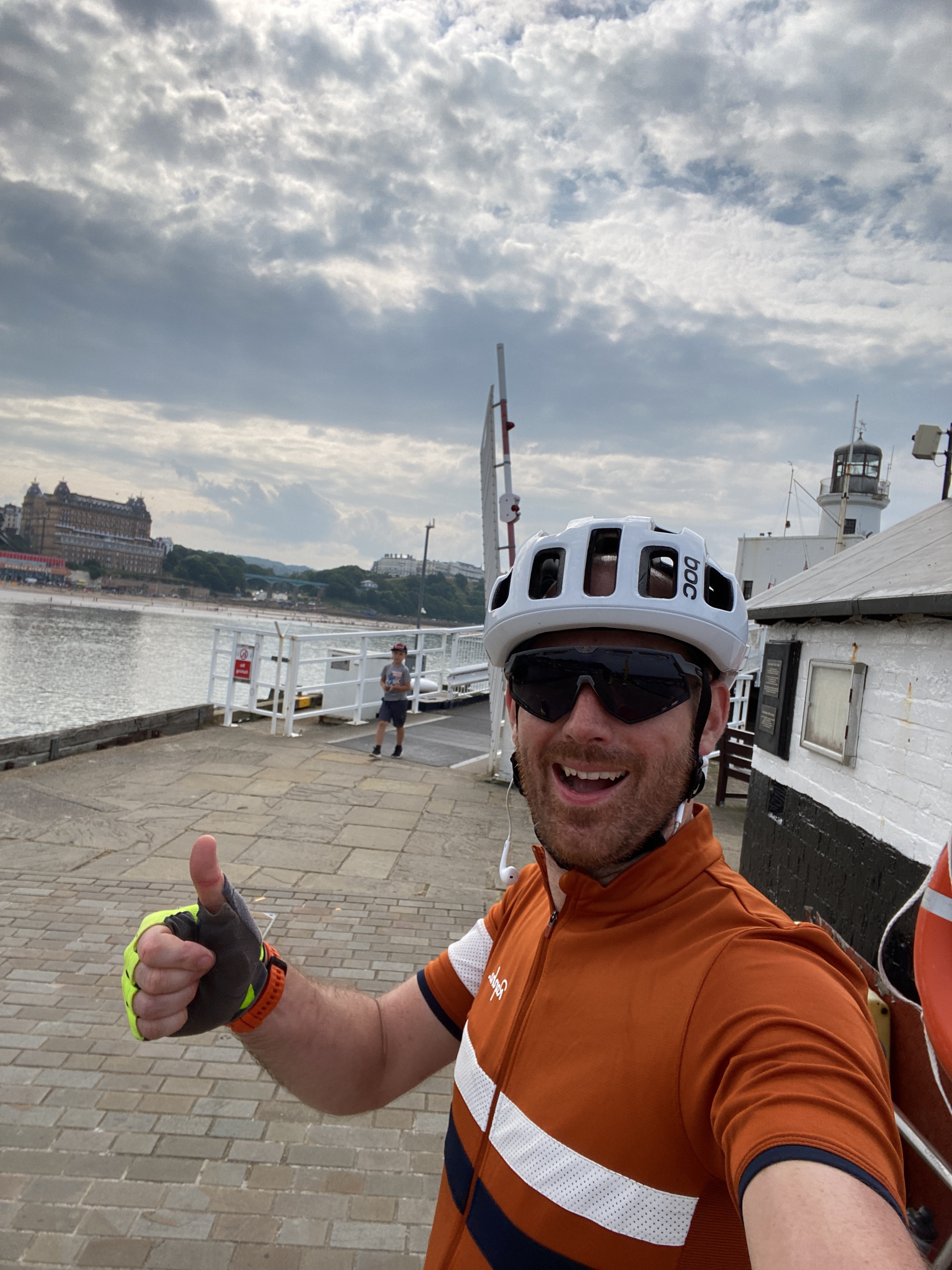
Thankfully the last stretch into Scarborough was uneventful. A surge of “almost there” energy had me racing to the seafront, where a huge number of people were making the most of what had turned out to be a warm, sunny day.
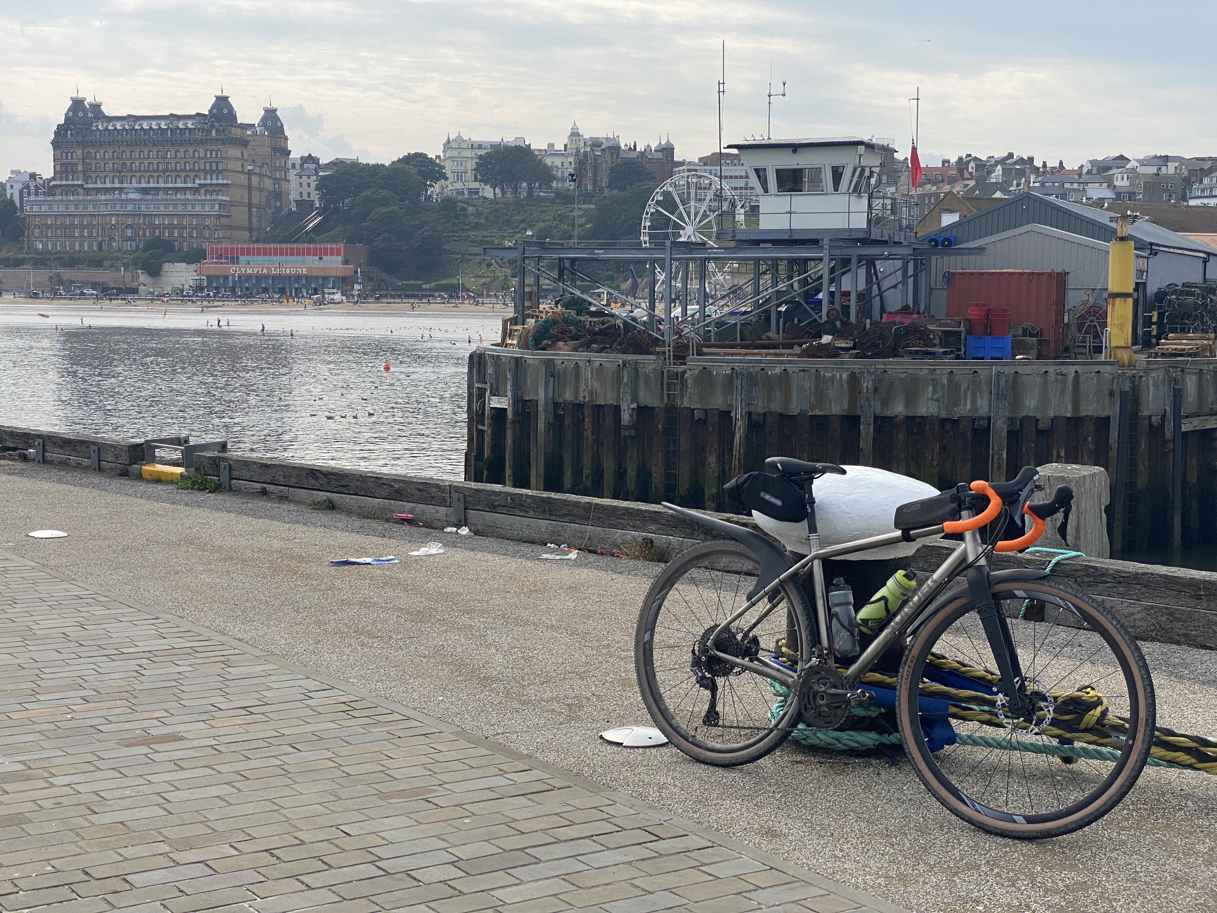 The pier in Scarborough. The sea is such a great place to end a ride
The only thing left to do was hide the bike in the car, meet some friends on the beach, and fight off seagulls while we devoured fish and chips.
Would I recommend the route? Absolutely.
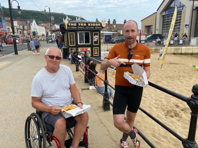 What’s a trip to the seaside without fish and chips?
Route alterations & roadblocks
If you’re riding EnglanDURO21, or just following the route sometime soon, here’s a summary of the alterations I had to make. You can see my full tracks on Strava for day one and day two.
- Windle Edge/Pennine Sailing Club (Google maps). The track is now private land, so stay on Windle Edge (don’t turn into the sailing club) into Townhead to rejoin the route.
- Pugneys Park near the end of the lake (Google maps) has fenced off the track, but if take the north fork at the point on the map (rather than north-east following the route) you can join it a little further on.
- The Fairburn Ings entrance from the Aire & Calder Navigation towpath (Google maps) is footpath-only. If you’re early in the morning or late in the evening this is probably fine, but the path is quite narrow in places so best avoided when it’s busier. To avoid it completely, stay on the A656 and follow it into Allerton Bywater before turning right onto Newton Lane to rejoin the route (see diversion on OpenStreetMap). This diversion only adds a couple of hundred metres to the day.
Links
- Huge thanks to the Racing Collective for putting the route together: https://www.theracingcollective.com/englanduro.html
- Day one track: https://www.strava.com/activities/5691283829
- Day two track: https://www.strava.com/activities/5695664642
- #EnglanDURO21 Spotify playlist: https://open.spotify.com/playlist/0BgDygP557YMg5KMSsflAO?si=55af91d8c27044e6
- The Twilight of Democracy on Audible: https://www.audible.co.uk/pd/Twilight-of-Democracy-Audiobook/0241481821
This post was originally published on Medium.